
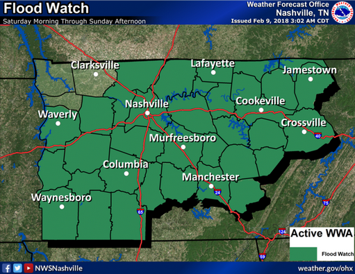
Flood Watch From Saturday Morning Through Sunday Afternoon
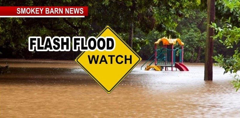
ROBERTSON COUNTY & MIDDLE TENNESSEE: (Smokey Barn News) – A Flood Watch in effect from Saturday morning through Sunday Afternoon for much of Middle Tennessee according to the US National Weather Service Nashville Tennessee. Continuous rainfall…rain may be heavy at times.
A cold front will approach the mid state tonight and will stall across the area on Saturday. A series of surface lows will move northeastward along the boundary and add to the low level forcing that is in place.
 The southwesterly mid and upper level flow will provide a moisture rich airmass. With this combination of deep moisture and vertical lift, copious rainfall amounts are expected during the watch period. The Flood Watch is in effect for that portion of Middle Tennessee along and to the east and south of a Springfield to Waverly line. A deep southwesterly flow aloft will combine with a slow moving frontal boundary to produce heavy rainfall during the watch period. The rainfall on Saturday and Saturday night will be heavy at times.
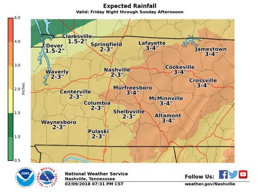
Rainfall amounts will average around 2 to 4 inches, with areas along the Cumberland Plateau seeing the greatest amounts. Rainfall amounts of 2 to 4 inches will cause many rivers and streams to reach and potentially surpass flood stage levels.
Precautionary/Preparedness Actions:
A Flood Watch means there is a potential for flooding based on current forecasts. You should monitor later forecasts and be alert for possible Flood Warnings. Those living in areas prone to flooding should be prepared to take action should flooding develop.

Smokey Barn News (Sponsor/Advertisement)

We bring you ALL the News in and surrounding Robertson County, Tennessee.