
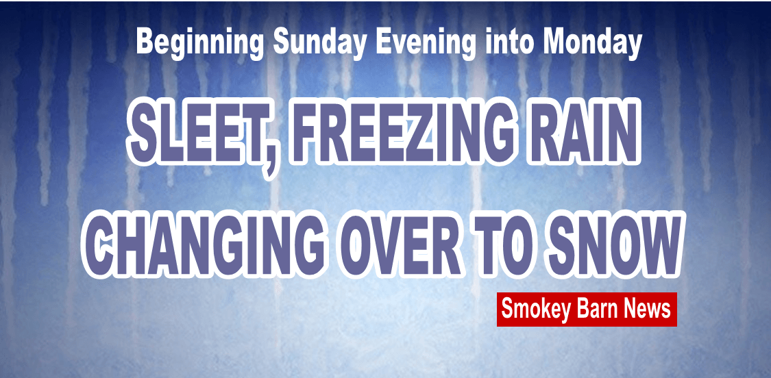
* ice/sleet accumulations… One quarter to one half inch expected in Robertson…
Smokey Barn News (Sponsor/Advertisement)
Smokey Barn News
Sunday March 2, 2014
Robertson County, Tenn.
UPDATE Watch changed to Winter Storm Warning
… Winter storm warning remains in effect until 9 am cst Monday…
* geographic area… For locations generally along and northwest of a line from linden… To Ashland city… To cross plains.
* ice accumulations… One half up to one inch.
* snow accumulations… From a dusting from southern Perry county up to two inches for locations approaching the Kentucky border.
* timing… Noon until 9 am Monday.
 * main impact… Hazardous driving conditions are expected due to freezing rain… Sleet and snow. Trees and power lines will likely experience significant ice accumulations… Resulting in power outages.
* other impacts… With north winds of 15 to 25 mph with gusts approaching 35 mph possible… This could worsen ice accumulation problems on trees and power lines.
Precautionary/preparedness actions…
A winter storm warning means significant amounts of snow… Sleet… And ice are expected or occurring. Strong winds are also possible. This will make travel very hazardous or impossible.

Reported earlier…
Smokey Barn News
Saturday March 1, 2014
Robertson County, Tenn.
… Winter storm watch in effect from Sunday afternoon through late Sunday night…
The national weather service in Nashville has issued a winter storm watch… Which is in effect from Sunday afternoon through late Sunday night.
A winter storm watch means there is a potential for significant snow… Sleet… Or ice accumulations that may impact travel.
* ice/sleet accumulations… One quarter to one half inch expected in Robertson County area. Beginning Sunday afternoon/evening changing over to snow early Monday and tapering off to flurries during the afternoon. Windy conditions with gusts as high as 35 mph will make temperatures feel like the teens with a high of 25 on Monday.
There is still some uncertainty concerning arrival timing and actual accumulation amounts… A winter weather advisory has been issued for other locations expected to experience accumulations of around or greater than one tenth of an inch but less than one quarter of an inch.
* main impact… Hazardous driving conditions will be possible due to ice accumulations from freezing rain and sleet. Trees and power lines could experience ice accumulations… Resulting in power outages.
* other impacts… With north winds of 15 to 25 mph with gusts approaching 35 mph possible… This could exacerbate ice accumulation problems on trees and power lines.
Stay tuned to this post for the latest forecasts and possible school or business closings.
Smokey Barn News (Sponsor/Advertisement)
We bring you ALL the News in Robertson County, Tennessee.
![]()
Everyone go to the store and buy out the bread, milk and eggs!