Severe Storms Predicted Thursday With Possible Flooding, & Threat For Tornadoes
ROBERTSON COUNTY TENNESSEE: (Smokey Barn News) – The US National Weather Service Nashville Tennessee predicts severe storms Thursday afternoon, March 25. The afternoon and evening are the peak times with potential for tornadoes, damaging winds of 60+ mph and possible flash flooding. Stay weather alert well into tomorrow night.
A Flood Watch is in effect from THU 1:00 AM CDT until FRI 1:00 AM
Flood Watch for Middle Tennessee, including the following areas, Bedford, Cannon, Cheatham, Clay, Coffee, Cumberland, Davidson, De Kalb, Dickson, Fentress, Giles, Grundy, Hickman, Houston, Humphreys, Jackson, Lawrence, Lewis, Macon, Marshall, Maury, Montgomery, Overton, Perry, Pickett, Putnam, Robertson, Rutherford, Smith, Stewart, Sumner, Trousdale, Van Buren, Warren, Wayne, White, Williamson, and Wilson.
Multiple waves of heavy rainfall from Thursday morning through late Thursday night will cause excessive rain amounts of 1 to 4 inches.
Heavy rainfall will cause excess runoff and localized flash flooding in the watch area.

“IMPORTANT: Do NOT think if your area isn’t highlighted that you’re in the clear. This is where the *best* chances for severe weather to occur are located.
Take the time this evening to make sure the batteries are fresh in your NOAA Weather Radio and tomorrow, make sure your cell phone is charged. Remember, we want you to have multiple ways to get warnings.
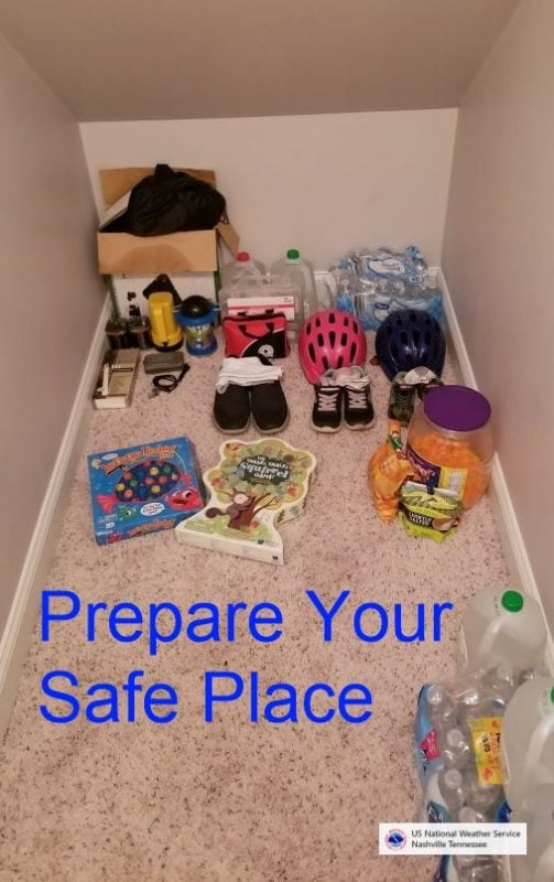
The US National Weather Service Nashville Tennessee also advises everyone to start getting those safe rooms ready TODAY! “Don’t forget to include snacks/games for the kids & items for your pets. Where is your safe place?”


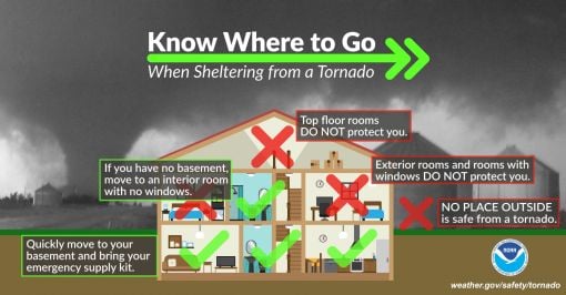
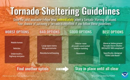


BE PREPARED: Before the Storm Strikes. (A message from Weather.gov)
At home and at work, your primary concerns are the potential loss of heat/AC, power, telephone service, and a shortage of supplies if storm conditions continue for more than a day. Test units regularly to ensure they are working properly. Have available:
• Flashlight and extra batteries.
• Battery-powered NOAA Weather Radio and portable radio to receive emergency information. These may be your only links to the outside.
• Extra food and water. High energy food, such as dried fruit or candy, and food requiring no cooking or refrigeration is best.
• Extra medicine and baby items.
• First-aid supplies.
• Have proper ventilation.
• Fire extinguisher and smoke detector.
In cars and trucks, Plan your travel and check the latest weather reports to avoid the storm!
Mobile: To See The Latest Stories or to share this article, scroll below