
The Daily Brief…. Sunday, May 26, 2024
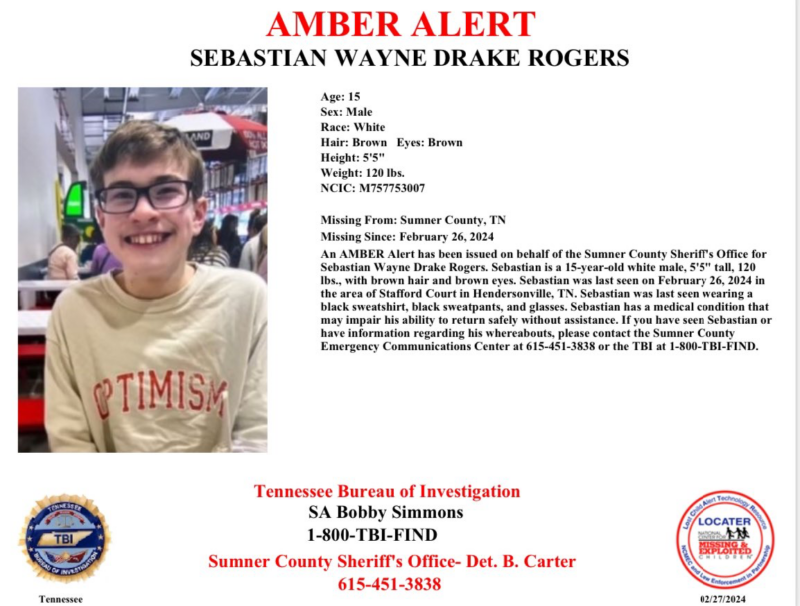
STORIES- Tornado watch, trees down, Teen still missing…
SUNDAY
ROBERTSON COUNTY, TENNESSEE: (Smokey Barn News) – The Daily Brief covers alerts and social media posts that don’t make it out to our website. We have received numerous messages from Smokey readers that are not on social media and therefore miss many alerts. If you are not on Facebook, Instagram, or Twitter (X) then this report is for you. This report will mirror all of our social media accounts.
Updates will be added to the Daily Brief throughout the day. No Daily Brief simply means there were no social media posts that day. Just reload this page to see the most current content for Sunday, May 26, 2024 So, if you are not on Social media, Smokey’s Daily Brief will keep you in the loop!
Are you enjoying the Daily Brief? Please send us a note to [email protected] or text us at 615-513-9844.
RELOAD THIS PAGE FOR NEW REPORTS AS THEY COME IN…..

Smokey’s weather guy Bill Jones says we could have more coming but there’s no way to know how bad. He says all the ingredients are there but it’s still a guess. He says to stay up and stay alert. Bill says it will hit around 11pm.
Get that weather radio out of the garage. Be sure to put some batteries in it in case we lose power and have the entire household plug in their smartphones now.
According to the Director of the Emergency Management Agency Chance Holmes, we did get some flooding and we’ll likely get more this evening. The Director highly recommends that citizens stay off the roadways to avoid what we had last week.
Quick water rescues put everyone’s life in danger.
CLICK HERE to see a weather pix sent to Smokey. They are on Facebook but you should be able to X out of the join window if you are not on Facebook.
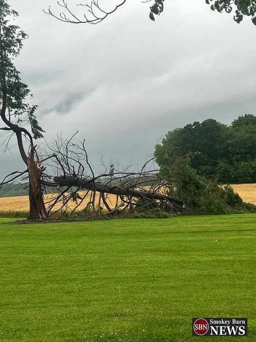
Tree snapped in half in Springfield, North end of Robertson County close to Lamont Road near State Line Road. PHOTO: Alicia Morris
HEAVY RAIN AND HAIL REPORTED IN SPRINGFIELD
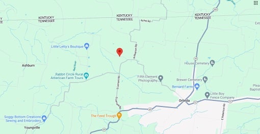
Did We Have a Tornado Touchdown in Robertson County?
Officials from the Robertson County Emergency Management Agency and Robertson County EMS are en route to Lamont Road and McDaniels Road to assess damage caused by the recent storm. They aim to determine if there was a tornado touchdown. If you live in that area and have any photos or videos, please text them to 615-513-9844 or email them to [email protected].
POWER OUTAGES
The grid is in good shape, but approximately 650 people in Robertson County are currently without power. The outages are small and scattered, so it may take some time for crews to address them all. The good news is that CEMC and Springfield Electric are very efficient, so if your power is out you will likely see repair crews soon. Keep in mind that more weather is on the way.
Tree down at Kinneys and Holman Rd. PHOTO: Colleen Daley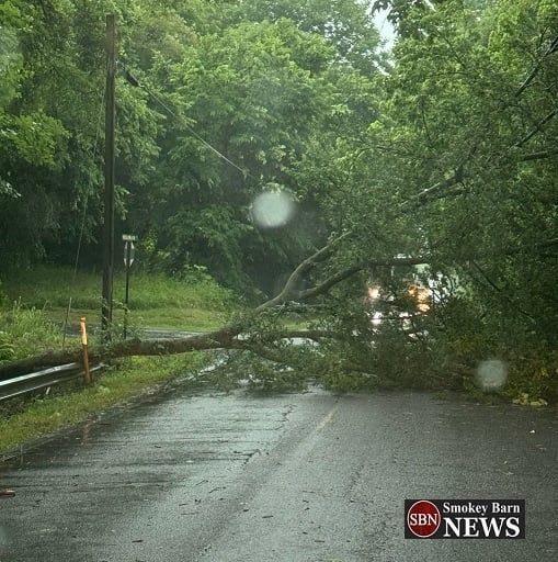
TREES DOWN
We have numerous reports of trees down across the area. The ground is saturated so more are likely to come down and we have more weather ahead of us.
WEATHER AND TRAFFIC ALERT FROM ROBERTSON COUNTY EMS
TORNADO WATCH IN EFFECT
The National Weather Service has issued a Tornado Watch until 3 PM CDT this afternoon. Previously, we were under a tornado warning, but it has now been scaled back to a watch.
LOOKING FOR EYEBALLS?
Did you know that Smokey likely has a reader in every home in Robertson County? That’s well over 146,000 eyeballs!! Our influence extends into Sumner, Cheatham, Montgomery, and Davidson Counties, reaching even into lower Kentucky! As a trusted news source for over a decade, we have the eyeballs you want.
Join our list of ever-growing sponsors like Stewart Williams Furniture, Payne Chevrolet, Springfield Carpet One, Chosen Towing & Recovery, TriStar NorthCrest Medical Center, Ponce Law, HealthMarkets Insurance Agency, Xfinity, McDonald’s, ACE Hardware, and many more! Partner with us and tap into our large following to amplify your message and grow your business. [email protected] Or call 615-513-9844 and say Sales, please!

RELOAD THIS PAGE FOR NEW REPORTS
Looking for Local Events OR Community Meetings?
Check out our SBN Events & Announcements Page. Bookmark and save for future events. We work hard to bring you info on upcoming Car shows, Fun Fests, Gospel Sings, Dances, 5K Walk/Runs, Potlucks, Job Fairs, Turkey shoots, fundraisers and local community meetings where you can learn how to stay more connected in our community. Just Click the Banner below to head on over to the page…
Check this page often for new info!
RELOAD THIS PAGE FOR NEW REPORTS
Mobile: To See The Latest Stories or to share this article, scroll below