
Severe Storms To Roll Into Middle Tennessee Later This Evening
ROBERTSON COUNTY TENNESSEE: (Smokey Barn News) – Severe thunderstorms are predicted to pass through Middle Tennessee later this evening with a strong potential to bring damaging winds according to the US National Weather Service Nashville Tennessee.
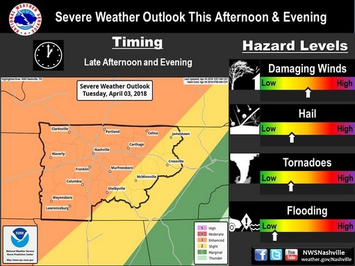
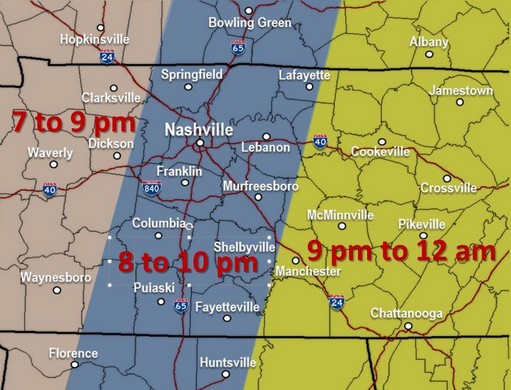
If you don’t have your plan in place, now’s the time to do it! A line of intense thunderstorms will race across the area this evening. The storms are expected to arrive in the Robertson County area around 8PM and move out by 10PM. The primary concern is powerful, damaging straight line winds, but large hail and isolated tornadoes will be possible, too. Best chances for hail will be along and west of I-65, but all of Middle TN will have at least some threat through about midnight.
Do not take severe thunderstorm warnings lightly tonight. 80 mph winds are 80 mph winds. It does not matter if the winds are straight-line or tornadic.
Temperatures will be much cooler for Wednesday. Frost expected Thursday morning for most of the area with below freezing temperatures. Friday may bring us a little rain with a potential for snow on Saturday.
This is a timing graphic of the approximate times you can expect severe weather in your area.
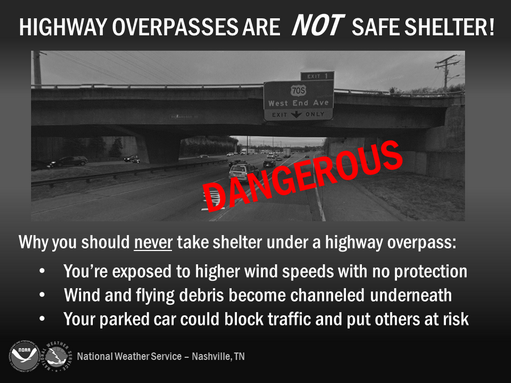
Severe storms are heading to Middle Tennessee later this evening. Overpasses are not a safe place to take shelter. If a tornado warning is issued it’s best to find a sturdy building to take shelter. Or better yet, avoid being on the highways altogether when the storms are forecast to hit.
Need some help with your plan? Click Here

Smokey Barn News (Sponsor/Advertisement)

We bring you ALL the News in and surrounding Robertson County, Tennessee.