
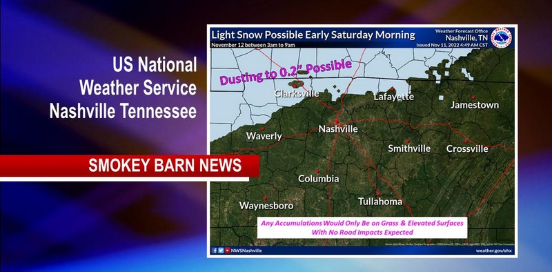
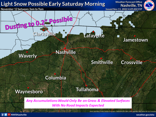
Snow Tomorrow? Say It Aint So… Computer Model Says Yes
ROBERTSON COUNTY TENNESSEE: (Smokey Barn News) – After a rainy day today thanks to former Hurricane Nicole, a strong cold front will move through Middle Tennessee tonight bringing another round of rain after midnight through Saturday morning, according to the US National Weather Service Nashville Tennessee.
Temperatures appear they will get cold enough for some of the rain to mix with or change to snow in far northwest and northern Middle Tennessee.
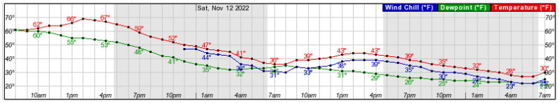
A light dusting to a couple tenths of an inch of snow is possible on grassy areas or other elevated surfaces. However, temperatures will remain above freezing.
Smokey Barn’s Weather predictor Will Jones has looked at the data and agrees that the possibility of snow is there but it is very unlikely that there will be any accumulation. The ground is still very warm, so roads will not be impacted.

WHAT: Light snow possible early Saturday morning
WHEN: Between 3am-9am
WHERE: Far northwest and northern Middle Tennessee (Stewart, Houston, northern Humphreys, northern Dickson, Montgomery, Robertson, Sumner, Macon Counties)
IMPACTS: No impacts to roads or other infrastructure are expected.
Mobile: To See The Latest Stories or to share this article, scroll below